

Niantic Spatial and Spexi Are Turning Drone Footage Into 3D Maps for AI
Physical AI, the growing field of artificial intelligence systems meant to understand and act in the real world rather than just process text or images, has one persistent problem: it needs an accurate, detailed model of the real world to actually learn from. Niantic Spatial and Spexi Geospatial think they've found a practical way to build that model at scale, and they've announced a partnership pairing Spexi's drone imagery network with Niantic Spatial's 3D reconstruction technology to convert aerial footage into usable 3D intelligence.
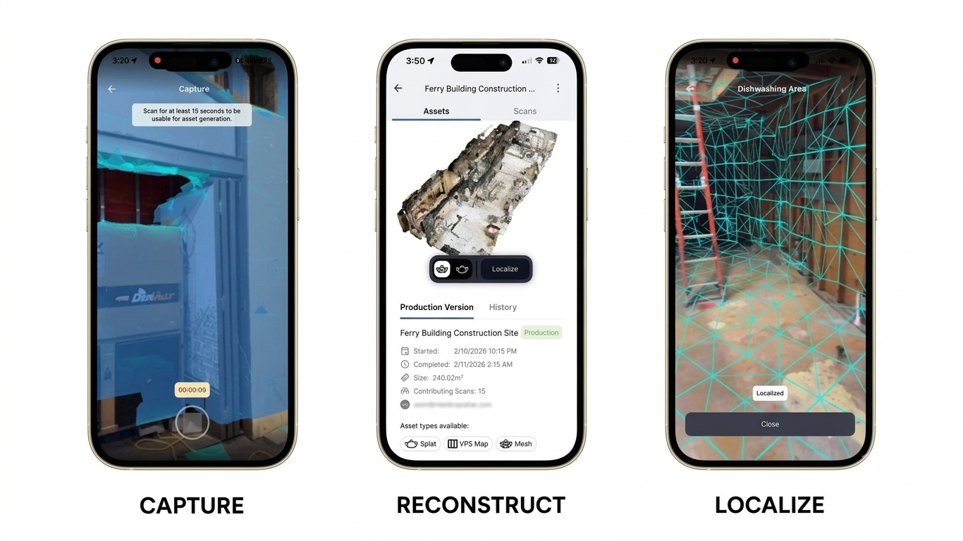
The mechanics of the deal are fairly straightforward once you break them down. Spexi already runs a network of drone pilots who capture standardized aerial imagery of real-world locations. Under the new partnership, customers will be able to commission a drone capture through Spexi and then run that imagery through Niantic Spatial's Reconstruction API, which converts it into a geometrically accurate 3D model rendered as what's known as a Gaussian splat — a technique that represents a scene as a dense field of tiny 3D points rather than a traditional mesh, allowing for photorealistic, walkable reconstructions. Those reconstructions come out geo-referenced, meaning they carry real-world coordinates and can be dropped straight into a larger map, and customers can view and measure them directly inside the Spexi World platform without needing a separate tool.
Spexi has also been named a preferred drone imagery provider for training Niantic Spatial's real-world foundation models, the underlying AI systems the company is building to give physical AI a grounded sense of real environments. That's a notable detail because it pushes the partnership beyond one-off customer projects and into an ongoing pipeline: Spexi's captures feeding directly into how Niantic Spatial's models learn about the world at increasingly large scale. Niantic Spatial CEO Inhi Cho Suh made that scaling point explicitly, noting that high-quality 3D reconstruction has historically been limited to individual objects or buildings, and that pairing Spexi's network with Niantic Spatial's reconstruction and modeling technology is meant to push that up to city-scale environments and beyond.
To put Spexi's side of that in perspective, the company operates a network of more than 10,000 drone pilots using standardized, autonomous flight protocols specifically designed to produce machine-learning-friendly data, and it has already mapped more than six million acres at 2.8 centimeter resolution — roughly ten times sharper than what satellite imagery typically offers. Niantic Spatial's reconstruction pipeline has reportedly been tuned specifically to match how Spexi's drones capture data, which is presumably what makes the integration between the two platforms fairly seamless rather than a bolt-on partnership. Beyond mapping for its own sake, the companies pointed to a fairly wide range of practical applications for the resulting 3D models, including infrastructure inspection, insurance risk assessment, energy site analysis, asset management, and general-purpose 3D measurement, alongside the simulation and location use cases you'd expect from a company like Niantic.
Spexi CEO Bill Lakeland described the partnership as a way of collapsing what used to be a multi-step, multi-vendor process into a single workflow — going from raw drone footage to something a customer can actually act on, without having to stitch together imagery, reconstruction, and visualization tools from separate providers. Given how much of the current AI conversation revolves around models needing better real-world data to train on, pairing a large-scale drone capture network with a dedicated 3D reconstruction pipeline looks less like a niche mapping upgrade and more like an attempt to build genuine infrastructure for the physical AI systems that companies across robotics, autonomous vehicles, and simulation are racing to develop.